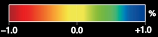
3D Global Seismic Tomography (GAP_P4, Obayashi et al., 2013, Fukao and Obayashi, 2013)
- Seismic tomography model: GAP_P4 (velocity perturbation of P-wave), Obayashi M. et al., Finite frequency whole mantle P-wave tomography: Improvement of
subducted slab, Geophys. Res. Lett., (2013), Fukao Y., M. Obayashi, Subducted slabs stagnant above, penetrating through and trapped below the 660-km discontinuity. J. Geophys. Res., (2013)
The horizontal resolusion is reduced from the original 576 x 288 (longitude x latitude) to 288 x 144.
-
P-wave (download eps file)
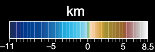
- Topography: ETOPO1, Amante, C; Eakins, B W (2009): ETOPO1, Global Relief Model converted to PanMap layer format. NOAA-National Geophysical Data Center, PANGAEA, doi:10.1594/PANGAEA.769615 (download eps file)
- Moho depth: CRUST1.0, Laske, G., Masters., G., Ma, Z. and Pasyanos, M., Update on CRUST1.0 - A 1-degree Global Model of Earth's Crust, Geophys. Res. Abstracts, 15, Abstract EGU2013-2658, 2013 (download eps file)
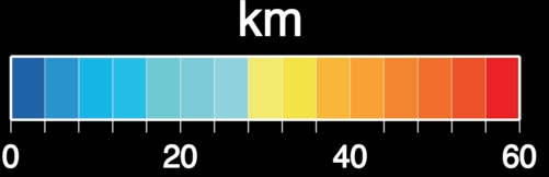
- Depth of lithosphere-asthenosphere boundary: LITHO1.0 (tessellation level 7), Pasyanos, M.E., T.G. Masters, G. Laske, and Z. Ma (2014). LITHO1.0: An updated crust and lithospheric model of the Earth, J. Geophys. Res., 119 (3), 2153-2173, DOI: 10.1002/2013JB010626 (download eps file)
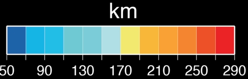
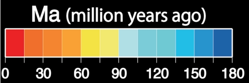
- Formation time of ocean floor: Agegrid (Earth Byte), Müller, R.D., M. Sdrolias, C. Gaina, and W.R. Roest 2008. Age, spreading rates and spreading symmetry of the world's ocean crust, Geochem. Geophys. Geosyst., 9, Q04006, doi:10.1029/2007GC001743 (download eps file)
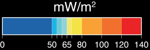
- Terrestrial heat flow: Goutorbe, B., J. Poort, F. Lucazeau, and S. Raillard (2011), Global heat flow trends resolved from multiple geological and geophysical proxies, Geophys. J. Int., 187, 1405–1419 (download eps file)
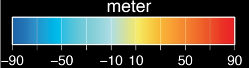
- Geoid height: EGM2008, Nikolaos K. Pavlis, Simon A. Holmes, Steve C. Kenyon, John K. Factor; Journal of Geophysical Research: Solid Earth (1978-2012) Volume 117, Issue B4, April 2012 (download eps file)
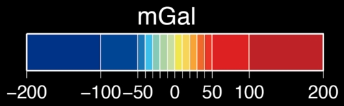
- Free-air gravity anomaly:WGM2012, Balmino, G., Vales, N., Bonvalot, S. and Briais, A., 2011. Spherical harmonic modeling to ultra-high degree of Bouguer and isostatic anomalies. Journal of Geodesy. DOI 10.1007/s00190-011-0533-4 (download eps file)
All the isodepth figures are created by GMT (Generic Mapping Tool, Wessel,P. and W.H.F.Smith, New, improved version of Generic Mapping Tools released, EOS Trans. Amer. Geophys. U., vol.79 (47), pp.579, 1998)